EU Deforestation Compliance with Cloud Spatial Analytics


In 2012, the United Nations designated March 21st as the International Day of Forests, aiming to foster global awareness of the indispensable value of forests. One year later, the World Resources Institute (WRI) launched the Global Forest Watch website, marking Global Forest Watch as CARTO’s first customer. Today, we are launching a solution to help organizations with their EU Deforestation Regulation (EUDR) compliance.

The EU Deforestation Regulation (EUDR)
Forests, spanning one-third of the Earth's land mass, play a crucial role in sustaining the livelihoods of 1.6 billion people. However, with our planet losing 10 million hectares annually to deforestation, and wildfires wreaking havoc across approximately 70 million hectares, the need for innovation for sustainable commodity production is imperative.

In 2023, the EU introduced the Regulation on Deforestation-free products, designed to stop deforestation caused by the expansion of agricultural land for commodities such as cattle, wood, soy, palm oil, coffee, rubber, as well as derived products such as leather, chocolate, tires, or furniture. Companies trading these products in the EU market are required to conduct diligence on their value chain to prove that the products don’t originate from recently deforested land. For organizations to prove compliance requires a thorough knowledge of their supply chain, and the locations of their sources, to check whether deforestation has occurred since 2020 - spatial analysis lies at the core of this.
There are many different ways to determine where there has been deforestation. The Forest Data Partnership promotes a ‘Convergence of Evidence’ approach for Forest and Commodities Monitoring, wherein no single source of geospatial data (i.e a land cover map) can tell the whole story around any given plot of land, but rather all the existing, published, and available datasets contribute to telling that story. To achieve this, the WRI, FAO, and partners, like Google, who formed the Forest Data Partnership, have been working on a methodology called WHISP. WHISP - which stands for ‘What IS in that Plot?’ - implements this approach by providing a transparent and public processing flow using these datasets.
.png)
Today, our founder, Javier de la Torre, is presenting a solution at the Food and Agriculture Organization of the United Nations (FAO) Headquarters in Rome on “Harnessing spatial analytics with BigQuery, Google Earth Engine and CARTO.” This solution incorporates methodologies like WHISP and allows organizations to perform spatial analysis on their data, leveraging the Modern Geospatial Analysis Stack, including CARTOs platform, Google Cloud, and Google Earth Engine.
Incorporating EUDR analysis to your organization’s spatial analytics infrastructure
To use our EUDR compliance solution, organizations can deploy it as a standalone tool or integrate it into their existing cloud data infrastructure. By connecting to your existing stack within Google Cloud, our solution offers notable benefits in terms of data governance and performance.
The core differentiator of operating on cloud-native architecture is that analysis and computing occurs directly within your existing cloud environment, rather than external to it. The processing you do can be stored as a procedure in your BigQuery data warehouse, ensuring optimal interoperability.
Another key benefit is CARTO's support for raster analysis within BigQuery, enabling the seamless intersection of raster and vector data. This approach allows for expanded sustainability analysis, connecting diverse datasets and leveraging the full cloud toolkit to align this methodology with your broader operational strategies.
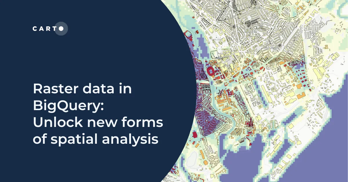
Learn more about using raster data in BigQuery in our blog!
Implementing the WHISP methodology using CARTO Workflows
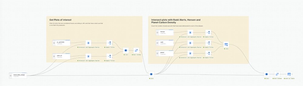
To implement the WHISP methodology for this solution, we used CARTO Workflows. Deployed on cloud infrastructure, Workflows can directly call Google Earth Engine for certain analysis, while in other cases it can handle all operations within BigQuery. This ensures that the analysis never leaves your data warehouse, thereby optimizing efficiency and reinforcing your data governance measures. In addition to this, using our Annotations feature and Workflows’ visual interface allows you to clearly outline the different steps of the WHISP methodology used for the solution, enhancing data transparency.
Using the WHISP methodology verifies whether the locations of an organization’s sources were pre-existing natural forests in 2020 and ensures that no deforestation or forest degradation has occurred since then. Subsequently, it checks for deforestation alerts by intersecting the locations with Radd Alerts, Hensen, and data on aboveground carbon density to quantify the number of pixels per plot that have been deforested for each plot.
Visualizing the raster and vector data in Builder
.gif)
The results from the EUDR analysis are then showcased using CARTO Builder, facilitating visual inspection. With Builder’s visualization capabilities for both raster and vector data, large datasets are easily visualized, making it particularly valuable for large organizations with extensive supply chains. This capability provides a comprehensive spatial view of their spatial data which allows stakeholders and decision makers to extract rich insights and simultaneously interpret diverse datasets.
Cloud-native spatial analytics for EUDR compliance
Organizations face several challenges when integrating EUDR compliance into their data governance framework. These include ensuring seamless connectivity to other processes, compliance with EUDR requirements, consolidating a single source of truth, and maintaining the credibility of the methodology used. Our solution is ideally suited for this process, being interoperable across the modern tech stack and cloud-native to enable huge-scale analytics and insight-driven visualizations. Users can also leverage our Generative AI functionality to further improve the efficiency and scale of this analysis.
It’s important to consider how deforestation analytics fit into your wider sustainability strategy. Our partner Vizzuality’s supply chain solution LandGriffon is one way of doing that.
Extensible by default: LandGriffon’s comprehensive supply chain solution
An example of our solution’s adaptability is showcased through LandGriffon, developed by our partner Vizzuality. LandGriffon provides a complete supply chain solution which extends its utility beyond EUDR compliance. By integrating this solution as a process into your data warehouse workflow, it becomes a versatile process from which other tools can harness the analysis and provide further spatial capabilities.
LandGriffon empowers proactive companies to surpass compliance and develop comprehensive sustainability strategies by providing data-informed insights into their environmental impacts. It enables measurement, analysis, and strategizing across four key areas: deforestation, carbon emissions, biodiversity loss, and water use. Through a spatial sourcing model, LandGriffon combines detailed information on high-impact commodities like cattle, cocoa, coffee, palm oil, rubber, soy, and wood with data on all raw materials, facilitating complete oversight and impact assessment.
These assessments adhere to standards set by the SEC Climate Disclosure Rule, Task Force on Nature-related Financial Disclosures (TNFD), and Science-Based Targets Network (SBTN). Moreover, LandGriffon’s integration with the EU Deforestation Regulation (EUDR) enables compliance teams to assess, validate, and mitigate deforestation risks aligned with regulatory requirements.
Find out more about innovating in sustainability at Google Next ‘24

If you can’t join us in Rome today, you can learn more about how you can ensure compliance with EUDR, drive operational efficiency, and gain a competitive advantage in the marketplace at Google Next ‘24 in Las Vegas.
📌 Booth 1771 - Mandalay Bay Convention Centre, Las Vegas
Don’t want to miss the opportunity to discuss these solutions? Book a meeting with us now!