

A new look for Positron and Dark Matter basemaps


Today we are excited to share the new and enhanced versions of our signature basemaps Positron and Dark Matter.
Since their initial release in 2014 Positron and Dark Matter have served as the unobtrusive backdrops for millions of amazing CARTO-based visualizations. We are confident that these refreshed designs will continue to serve that purpose while also giving your maps a fresh look.
A more efficient system
After the release of our newest basemap Voyager we spent time unifying our basemap infrastructure to get our internal system more efficient and connected -- all with the goal of streamlining our design and update processes.
What this means is that behind the scenes all of our basemaps share the same structure and the only thing that separates Voyager from Dark Matter or Positron is a set of variables that define their visual style. With this new system in place you can now switch seamlessly between each basemap without significant differences in data fonts and information content.
Cartographic enhancements
Cartographically we took this opportunity to fine tune the color system eliminate extra noise and introduce detail less aggressively than before. We also increased the visibility of some contextual information while pushing other information further to the background to improve overall legibility and visual hierarchy.
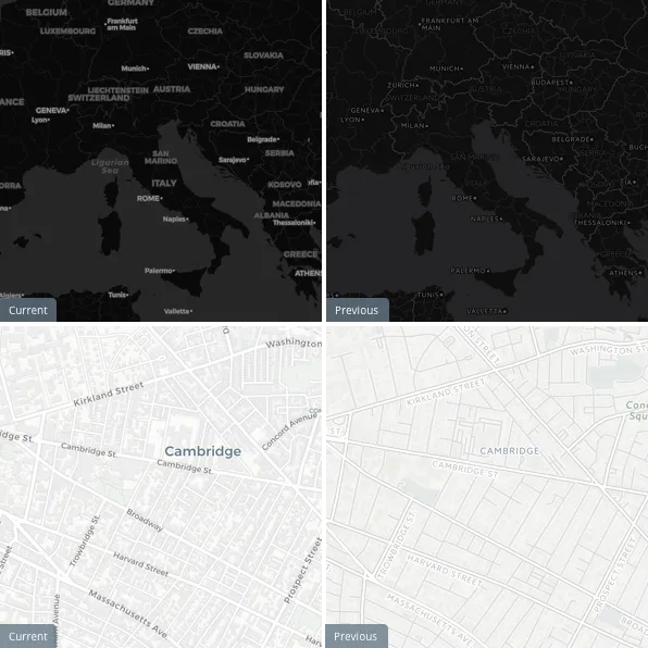
These small but significant changes will provide an improved figure-ground relationship between our basemaps and your data overlays.
We hope you enjoy these new designs and we are eager to see the maps you create with them!


