Recap of SDSC24: Climate Change, Geo AI & CARTO AI Agents!


More than 600 attendees from over 200 companies gathered at this year's Spatial Data Science Conference 2024 (SDSC24) in London. Participants came from telecommunications, insurance, and many other industries, reflecting the increasing relevance of spatial data science across diverse sectors.
Throughout the conference, three main themes stood out above the rest: the impact of climate change, GeoAI (Geospatial Artificial Intelligence), and data integration in the cloud. Additionally, CARTO announced several new product updates, including new AI agents and enhanced data processing capabilities by unlocking efficient raster analytics in the cloud.
Democratizing Spatial Data with CARTO
CARTO’s keynote, delivered by Founder & CSO Javier de la Torre, set the tone for the conference. The keynote focused on AI, sustainability, raster, and more. Keep reading for a recap of the announcements made during the CARTO keynote.

CARTO AI Agents
CARTO launched AI agents, a new update in CARTO Builder, which utilizes the latest LLM models. These agents can interact with spatial data and visualizations to uncover insights and meaning. They enhance efficiency by automating tasks such as map manipulation and direct analysis. Developed in collaboration with CARTO customers such as Mercado Libre, Aramex, VIOOH and BT - and powered by Google and Snowflake - these agents simplify complex spatial analysis for all users. This will help organizations make data-driven decisions faster and more accurately.
Request a demo with one of our geo experts to learn more about how you can leverage AI agents to un-silo geospatial at your organization!
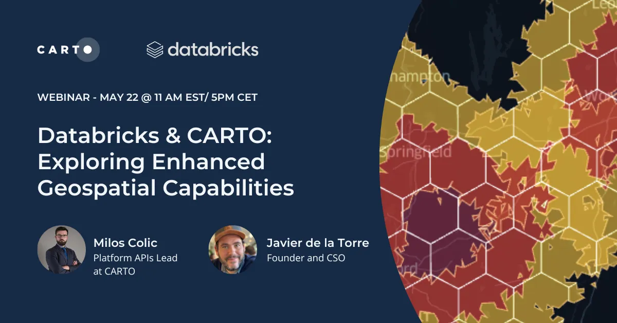
New Analytics Toolbox for Databricks
CARTO unveiled a new edition of our Analytics Toolbox for Databricks, leveraging their upcoming implementation of Native Spatial SQL. This toolbox allows users to work with all spatial data types within the Databricks ecosystem, enhancing spatial data analysis in modern data environments.
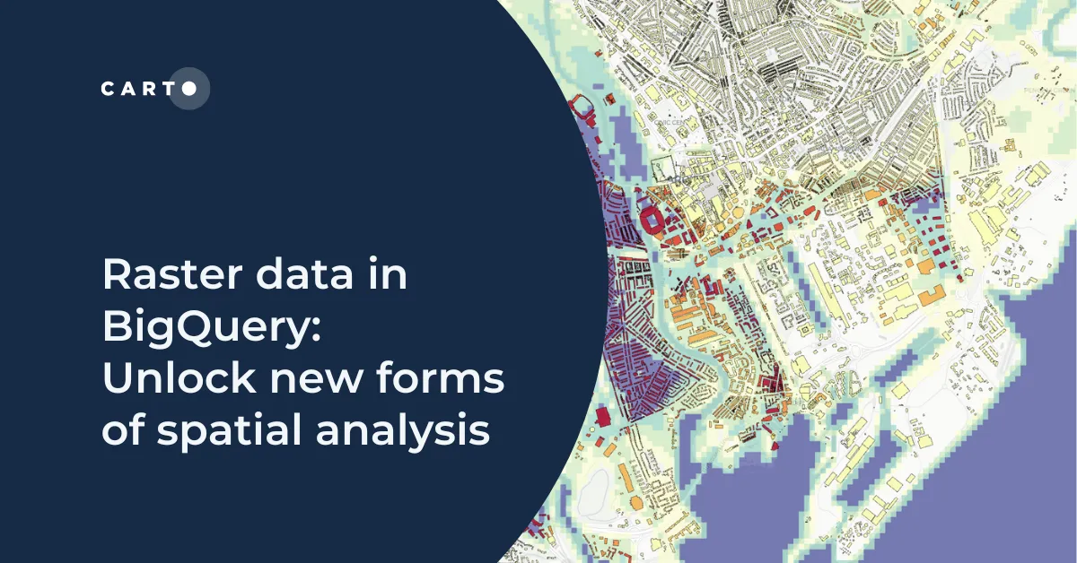
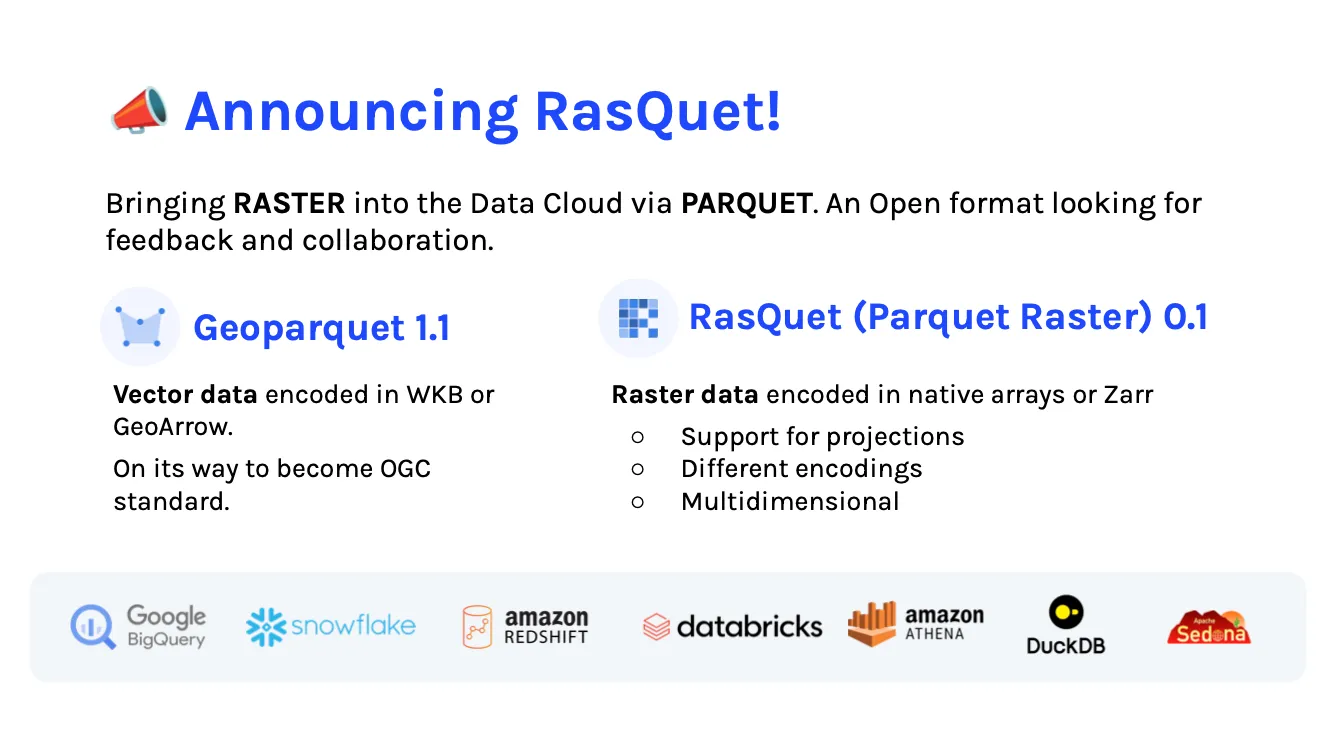
Raster Parquet
Raster Parquet is now available in your data cloud, aligning with CARTO’s vision of breaking the GIS silo by making spatial capabilities accessible - and interoperable - in modern analytics stacks. Raster parquet or ‘Rasquet’ stores data as multi-dimensional arrays, making handling large volumes of raster data easier. This simplifies working with big datasets and allows users to process and analyze spatial data in the cloud. By integrating seamlessly with non-geospatial data and supporting projections and encodings, Rasquet is designed for interoperability, enhancing the efficiency of spatial data analysis.
Spatial Data Science in 2024: Climate Change, Geo AI, and Data Integration in the Cloud
Following the CARTO keynote, the conference delved into three main themes. Each was highlighted across several presentations, showcasing the many applications of Spatial Data Science.
Climate Change
Climate change was a major focus at SDSC24, addressing the urgent need to tackle environmental challenges through Spatial Data Science.
Ben Crampton, Data Scientist, Dr. Rebecca M Mari, Senior Economist/Manager, and Rupert-Hu Gilman, Data Analyst, from the Bank of England, jointly presented on the impact of flooding on UK firms, showing how spatial data can be used to assess climate risks and inform policy decisions. They demonstrated how historical flood data - combined with economic data - can predict financial impacts on businesses, aiding in better future flood planning and economic stability. The analysis included data on the increasing incidence of flooding over the past 50 years and its economic cost, emphasizing the importance of leveraging geospatial to mitigate risks.

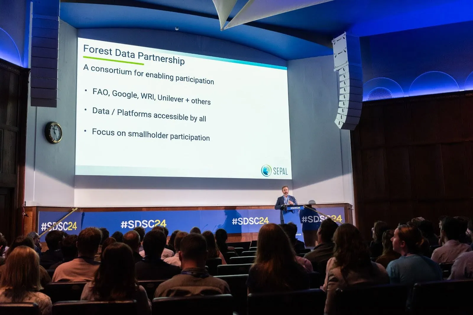
FAO's presentation on the Forest Data Partnership by Erik Lindquist, Forestry Officer at the United Nations Food and Agriculture Organization, highlighted efforts to support small-scale producers under the European Union Deforestation Regulation (EUDR). This initiative monitors deforestation and promotes sustainable commodity production using open-source geospatial tools. The partnership includes organizations such as Google, WRI, CARTO and Unilever, focusing on providing data and tools accessible to smallholders to ensure compliance and promote sustainable practices.
Dr Gennadii Donchyts, Cloud Geographer at Google, explained how tools like Google Earth Engine, Vertex AI, and BigQuery are used for applications such as climate risk, disaster response, and environmental mapping. Specific examples included near real-time wildfire mapping, flood risk assessment using Sentinel-1 SAR (Synthetic Aperture Radar) data, and sustainable agriculture practices using NVDI (Normalized Difference Vegetation Index) from Sentinel-2 imagery. Google’s platforms facilitate the analysis and visualization of complex environmental data, making it easier for organizations to address sustainability challenges.

GeoAI (Geospatial Artificial Intelligence)
GeoAI was another trending theme at SDSC24, with many speakers focusing on how they are leveraging AI to quickly derive more sophisticated insights from large-scale geospatial data.
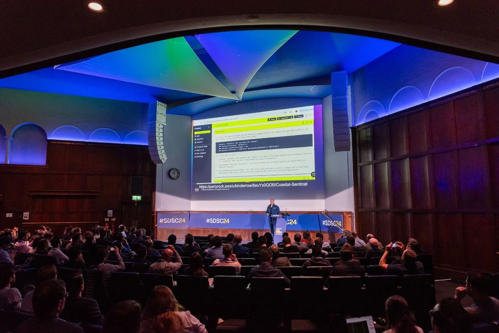
Phil Cooper, Global Geospatial Lead at Amazon Web Services, demonstrated how its infrastructure supports large-scale geospatial data processing and leverages generative AI (GenAI) to gain insights from these datasets. Through these developments, their goal is to make spatial data analysis and visualization more accessible and actionable for applications ranging from climate monitoring to urban planning. For example, Degas launched an LLM-based chatbot using Amazon Bedrock to help over 46,000 farmers in Ghana with regenerative agriculture practices. Another notable development announced was PartyRock, a platform powered by Amazon Bedrock that allows users to build AI-generated apps easily.
Snowflake also presented its GeoAI capabilities, focusing on modern location planning. Its integration with CARTO and the power of its Data Cloud platform was highlighted as key enablers of advanced spatial analysis and decision-making. Fawad Quereshi, Snowflake's Global Field CTO, emphasized the benefits of using GeoAI for enhanced site selection, traffic prediction, proactive maintenance, and cost optimization in telecom network planning. Additionally, Snowflake announced the availability of Overture Maps in the Snowflake Marketplace.

Data Integration in the Cloud
Data integration in the cloud was another major theme, with speakers emphasizing the need for seamless access to different types of data in one place for advanced analytical capabilities. Landmark Information Group presented on optimizing geospatial pipelines using H3 spatial indexing. James Bentley, Data Scientist at Landmark Information Group, demonstrated how this approach allows for efficient handling of large datasets, such as property data, by converting complex spatial queries into manageable grid cells, significantly speeding up processing times. This method enhances scalability and performance by reducing computational requirements and streamlining data integration processes.

BT showcased its Active Intelligence platform, which combines mobility and web/app data to provide insights into road usage across the UK. Chris Maydom, Data Scientist at BT, and Tim Rains, Geospatial Data Scientist at BT, highlighted how anonymized and aggregated data can reveal patterns in road usage, such as identifying home locations of road users and the impact of events like storms on traffic. For example, BT was able to detect a 200% increase in traffic due to an A90 closure during Storm Babet.

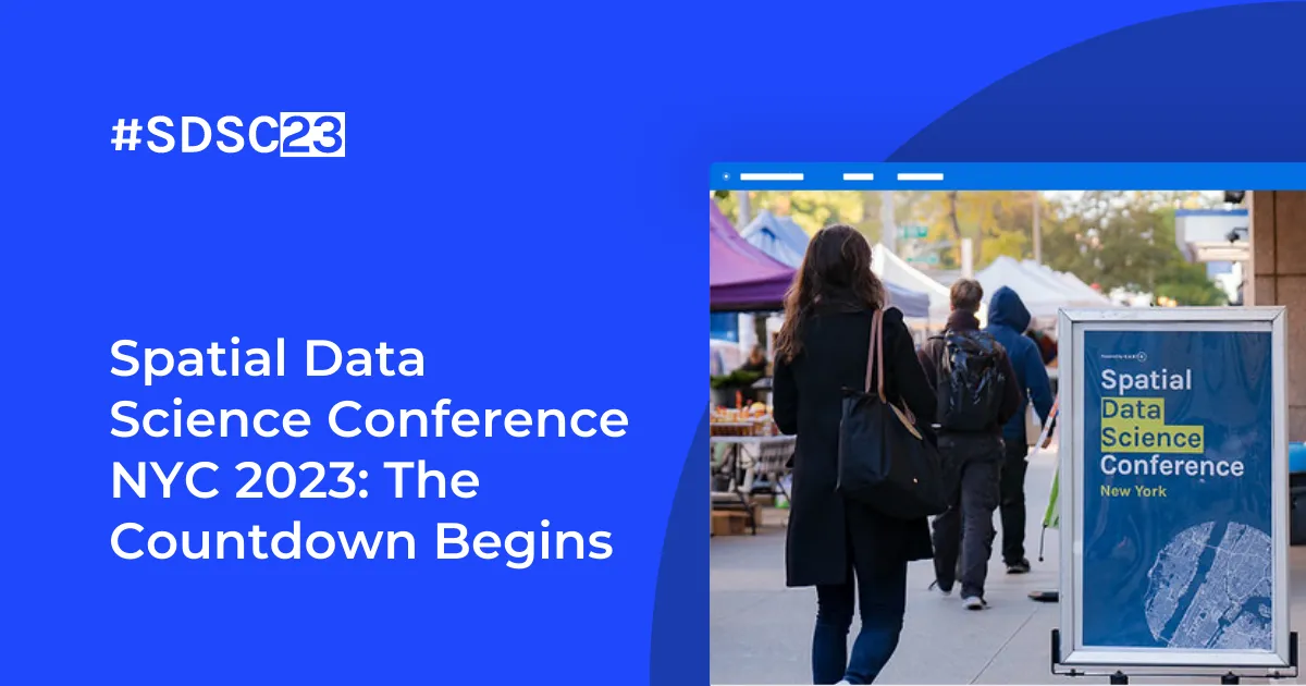
Get ready for SDSC24 New York!
The New York edition of the Spatial Data Science Conference is set to take place on October 16th & 17th at Columbia University. If the London edition gave you FOMO, don’t miss out — sign up here for updates on early bird access, speaker announcements, and more.
Additionally, the call for speakers for the NYC conference is now open. If you’re a professional in Spatial Data Science, submit your application!
Lastly, presentations from the London edition will soon be available on-demand on the SDSC24 website, so be sure to check back for updates.