What's New in CARTO - Q1 2024


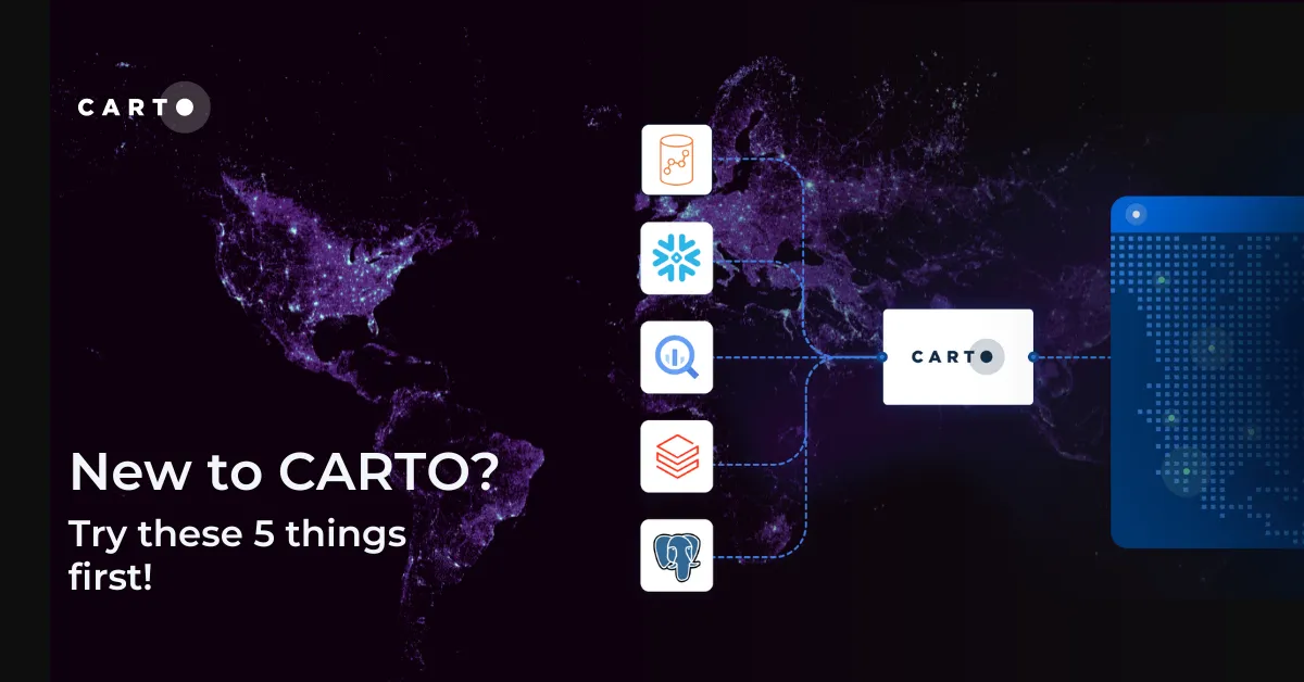
At CARTO, we’re committed to pushing the boundaries of spatial analysis and data visualization on top of the leading cloud data warehouse platforms. During this past quarter, we have continued releasing new features and enhancements into our cloud native platform, to empower our users to get the most out of their spatial data in platforms like BigQuery, Snowflake, Amazon Redshift, cloud-based PostgreSQL databases, etc.
In today’s data-driven world, unlocking the power of spatial data shouldn’t require extensive coding expertise. That’s why we keep focused on developing the best AI-powered low-code spatial analytics and map-making tools for the modern data stack. Our goal is to democratize spatial analytics, making it accessible to a wider range of users, from data analysts, scientists and developers to business decision-makers.
As you will learn throughout this article, we’ve extended the possibilities of CARTO Workflows with new pre-built components, workflow templates, and the option to trigger the execution of your pipelines with an API call. In CARTO Builder, we’ve added new customization options for your maps, as well as enhanced the possibilities to share and embed your dashboards in other platforms. Finally, our App Development toolkit has been improved with a new major release of deck.gl, and a new feature offering the possibility to join your data client-side with a collection of pre-generated tilesets of known administrative, statistical and postal boundaries for a much accelerated map rendering experience.
So now, please, sit down, get comfortable and enjoy reading about the latest developments in the CARTO Platform during these first months of 2024! And remember to regularly check our What’s New page to keep up to date with our most recent releases.
Support for configuring and executing your workflows with an API call
Helps you to… better integrate your spatial analysis in your organization’s wider data processes.
Users of CARTO Workflows can now trigger the execution of data preparation and analysis workflows by calling an API end-point. This new feature enables users to integrate their workflows into larger orchestrated processes, and to embed asynchronous analytical capabilities into web applications. In order to support this functionality we enabled a set of new features in the tool, from the possibility of defining variables that can be configured as parameters to input a configuration for the workflow, support for expressions to embed logic directly into workflow component settings, a controlled caching behavior, etc. Learn more about how you can trigger your workflows in this article!
Schedule the execution of your workflows and keep your insights always up-to-date
Helps you to… improve data governance, keep insights fresh and better align with other organizational processes
Analytical and data processes created with Workflows can now be scheduled so they are always executed based on a programmable period, such as hours, days, weeks or any custom cadence that you require. Thanks to this feature users can make sure that the results from their analyses and data transformations are always fresh and provide up-to-date insights.
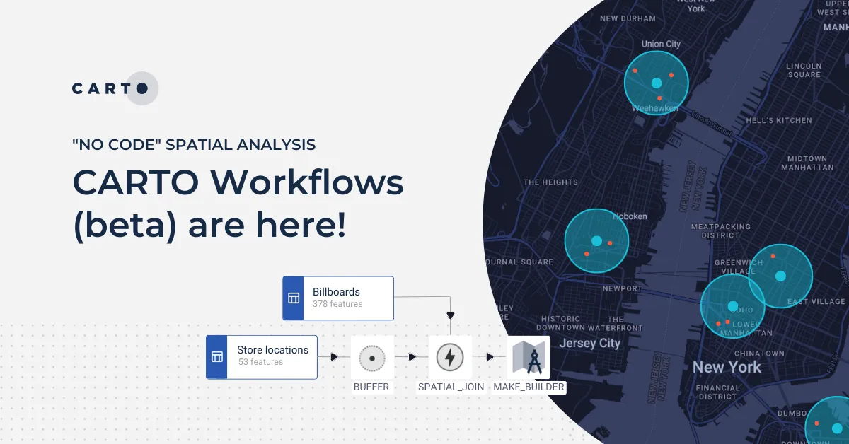
New Workflows components for low-code geospatial analytics
Helps you to… open up spatial analysis to more users, allowing for more efficient resourcing.
During these last few months we have continued to expand and improve our suite of pre-built workflow components, opening new possibilities for low-code geospatial analytics in CARTO. New examples include:
- Case When to generate new data based on conditional expressions
- Extract from JSON to extract values from JSON columns
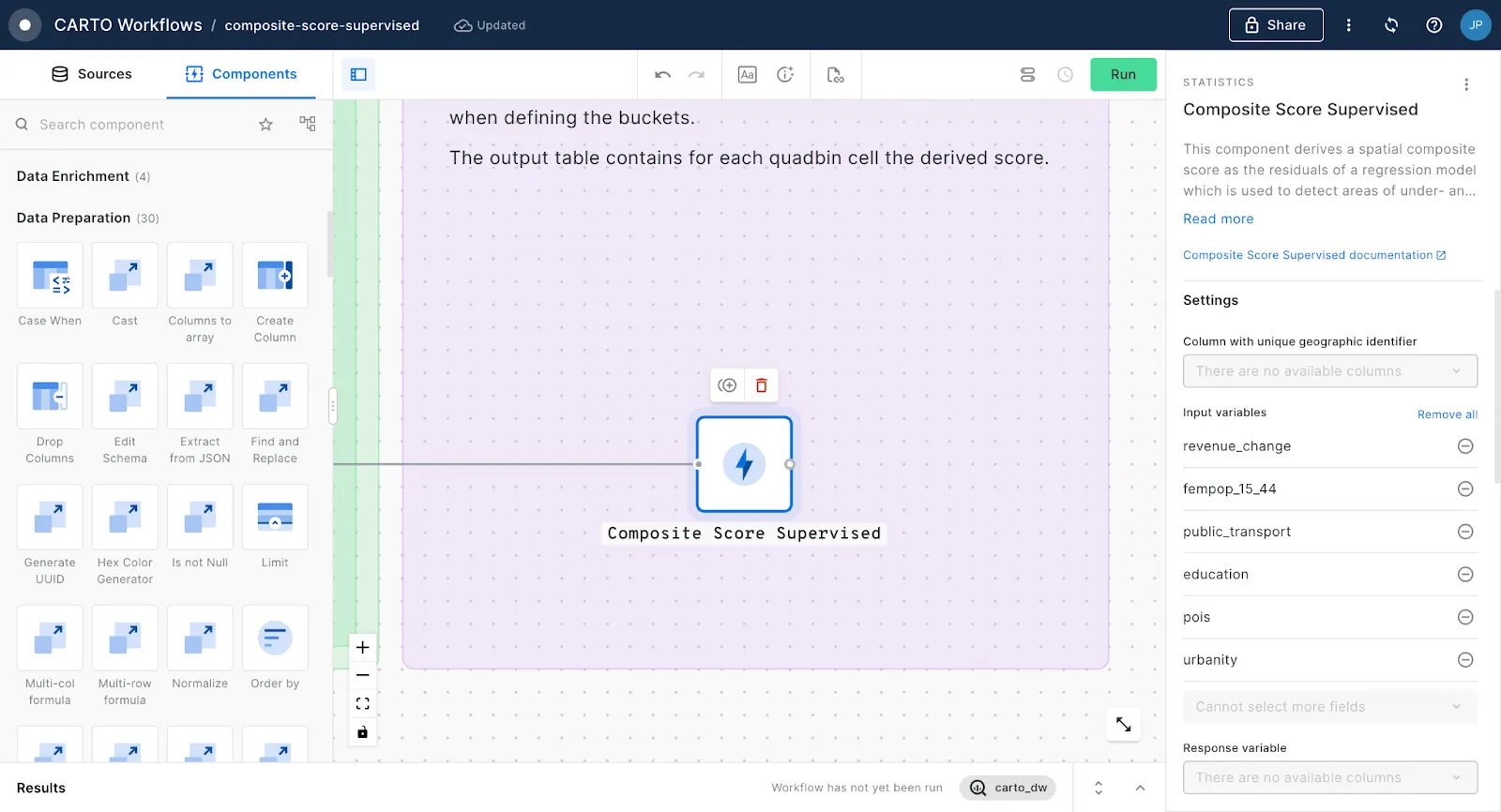
- Composite Score Supervised and Composite Score Unsupervised allow users to create spatial scores combining features from multiple data sources - read this article from our blog to learn more about composite scores!
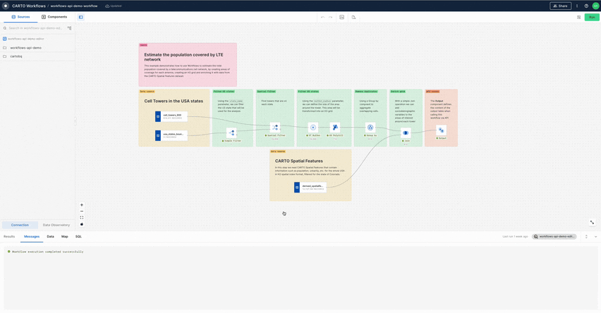
Need some help to start your analysis? Say hello to Workflow templates!
Helps you to… save time by not having to build complex analyses from scratch.
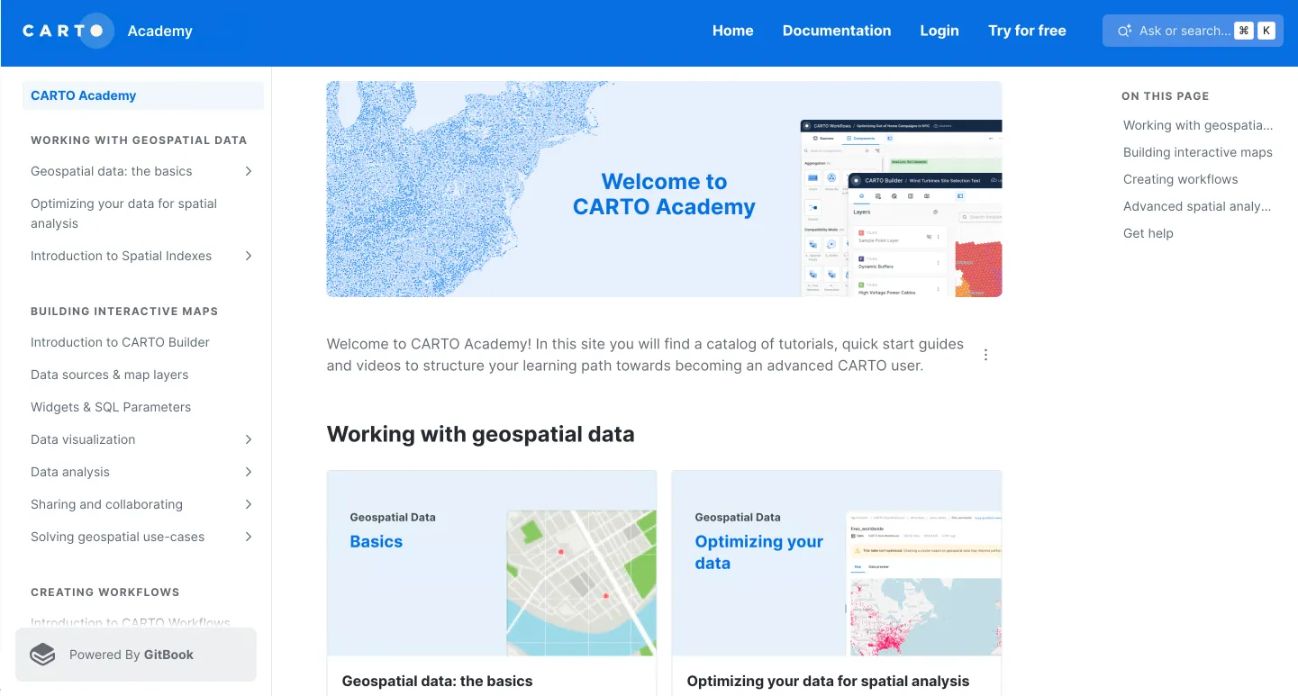
New to CARTO Workflows and not sure where to start? Enter our gallery of Workflow templates (available from the brand new CARTO Academy) and explore our collection of pre-built templates for a wide range of scenarios. Theserange from the simple building blocks for your geospatial analysis to more complex, industry-specific workflows tailored to concrete use-cases. Examples include filtering custom geographies for data preparation, calculating population statistics for telco network planning, creating a flood risk assessment for insurance, and much more! To use our templates you just need to download the SQL file and import it into your CARTO account - check out the video below to see just how easy it is!
Preview your Builder maps in viewer-mode before publishing them
Helps you to… ensure better quality control of outputs.
Users of CARTO Builder can now preview how their interactive maps look in viewer-mode before sharing them with other users or publishing them on the web. By allowing Editor users to preview what a Viewer user will see when accessing the map, this new feature allows them to ensure their dashboards offer the right visual and interactive experience before making them available to their entitled audience.
Extended support to control Builder maps with URL parameters
Helps you to… improve sharing capabilities and save time by adapting the same map for different purposes, rather than creating multiple versions.
We have expanded the URL parameter support in Builder maps to include widgets, SQL parameters, searched locations, and masks applied to filter features. Now, when viewers interact with these elements, the URL updates in real time, making it easier to share customized map views with your audience. This update opens up possibilities for creating varied views from a single map, simplifying sharing, and minimizing the need for multiple map versions. It also enhances the embedding of maps into websites or apps, providing a seamless user experience without unnecessary redirections.
Support for private embedding of Builder maps
Helps you to… improve embedding capabilities and ensure the security of your visualizations.
Maps created with CARTO Builder can now be embedded anywhere — even when they're not shared publicly. With private embedding you can restrict and maintain control over who can view these maps when embedded on web pages or apps. To leverage private embedding simply share your map with the organization or with the specific groups you want to share the map with. These users need to be previously logged-in to CARTO to view the embedded map. Learn more at our Embedding maps documentation.
This new feature together with our previously mentioned support for additional URL parameters offer our users a new set of possibilities to embed and control maps built in CARTO in other products such as Tableau, Looker, Retool, etc.
Release of deck.gl v9.0 and the future of geospatial visualizations
Helps you to… future-proof your apps and craft more flexible and seamless visualizations.
Just a few days ago we shared our excitement in this blog post about the new deck.gl major version: deck.gl v9. This latest version of deck.gl - the open-source visualization library that powers all maps in CARTO - is a future-proof developer library, ready for WebGPU and with Typescript enabled by default.
WebGPU is the next-generation interface between the GPU and the browser and we believe it has the potential to push the boundaries of what’s possible for web-based geospatial visualizations in terms of capabilities and performance. Other features developed by CARTO and the open-source community include UI widgets or the preview for CARTO Boundaries. The CARTO module in deck.gl has also been rewritten for better flexibility and reusability. We’ve covered all these changes in our blog, the deck.gl upgrade guide, and the brand new gallery of CARTO + deck.gl examples.
New CARTO Boundaries for faster visualizations in your spatial apps
Helps you to… easily access common boundaries for faster rendering of spatial data across multiple scales.
We have released in public preview “CARTO Boundaries”, a new feature that enables faster data visualizations of geospatial big data based on official, administrative, postal and statistical boundaries. CARTO Boundaries is a new type of visualization, included in the CARTO module of the recently released deck.gl v9, that unlocks a whole new performance dimension for large scale spatial visualizations. By separating the data - which can be filtered or aggregated dynamically - from the static boundary geometries, we not only accelerate map visualizations, but also offer a simplified architecture. This is because geometries do not need to be served on every request to the data warehouse. Check out our Boundaries Explorer and start using this feature in your app development projects today!
Boost your spatial analysis skills with the new CARTO Academy!
Helps you to… become a geospatial expert!
At the beginning of the quarter we were very happy to announce the launch of our new CARTO Academy, featuring detailed tutorials, videos and templates to boost your spatial analysis skills and make you a proficient user of the CARTO platform - and a geospatial expert to boot! In the Academy you will find:
- Materials to get you started with Spatial Indexes
- Tutorials to help you build stunning visualizations and spatial analyses with CARTO Builder
- Step-by-step tutorials and templates for Workflows
- Guides to develop your advanced spatial analysis skills with Google BigQuery, Snowflake and AWS Redshift.
We are really excited by this wave of enhancements and new features, and we hope you find them valuable and helpful to get the most out of your spatial data. To stay up to date on our most recent product releases remember to regularly check our What’s New page.
If you would like to find out more about these enhancements and get an update on our future product roadmap, why not sign up to our upcoming “What’s New in CARTO” webinar, taking place on Tuesday 16th April.