What's New in CARTO - Q4 2023


We say goodbye to another exciting and intense year at CARTO, one full of new developments to our cloud native spatial analytics platform. Transformational technology improvements that bring even more value to our users and partners. 2023 has been the year that we launched Workflows into general availability, providing a no-code tool to design, build and execute data preparation and analysis pipelines that run natively on the leading cloud data warehouse platforms, and benefit from all the functionalities we have built into our Analytics Toolbox. It has also been the year in which we have further enhanced Builder with support for SQL Parameters, new widgets and tools (to measure distances, and pinpoint a user’s location, etc.), we’ve also added rich descriptions and widget notes to improve your data storytelling. In 2023 we also released a new version of our Dynamic Tiling technology, the most advanced and performant solution to process and render geospatial data directly from a data warehouse, with a fully cloud native architecture.
Reflecting on the broader industry landscape, 2023 emerges as the “Year of GenAI”, a pivotal point for a technology that has arrived to no doubt change all human-computer interactions. At CARTO, we have already implemented key functionalities that leverage GenAI and the power of natural language processing models to optimize spatial analysis. On this topic, we are already working on the upcoming developments for 2024, in which we plan to use GenAI to dramatically increase productivity and ease access to geospatial insights for a broader group of users.
Looking ahead to 2024, we are excited for all of the innovation and new developments we have in our upcoming roadmap to empower users to extract value from their geospatial data in BigQuery, Snowflake, Redshift, and Databricks. But before we can showcase all of these new features, let’s take a deeper look at our main releases during the final months of 2023, so you can start benefiting today from these great, new developments.
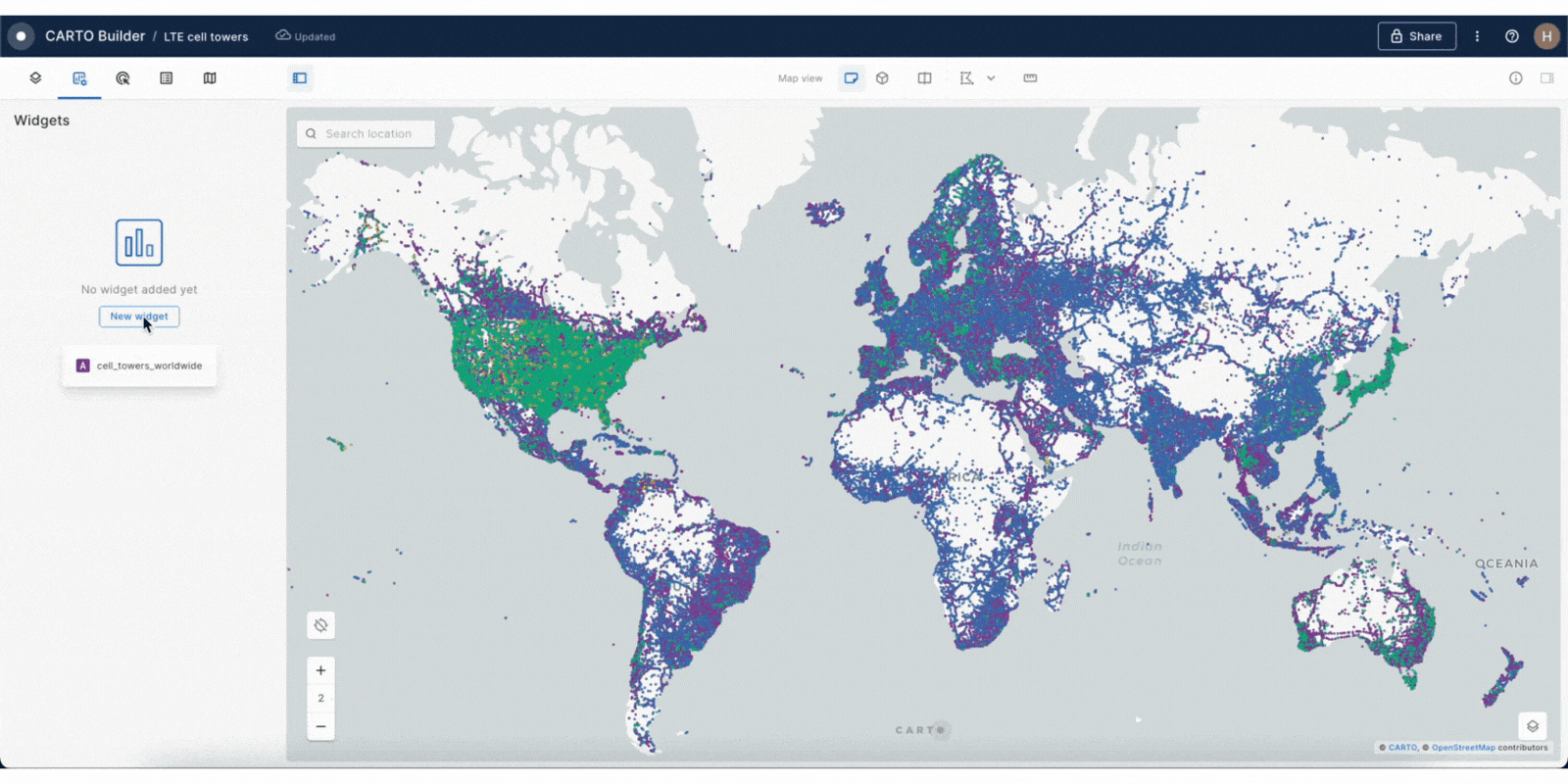
Pie widget to improve the analysis and visualization of complex categorical data
With the new pie widget in Builder, users have access to even more capabilities to visualize and analyze insights derived from complex categorical data.Thanks to this new feature users can quickly and easily analyze data proportions and category weights, providing a better understanding of each data category within your dataset.
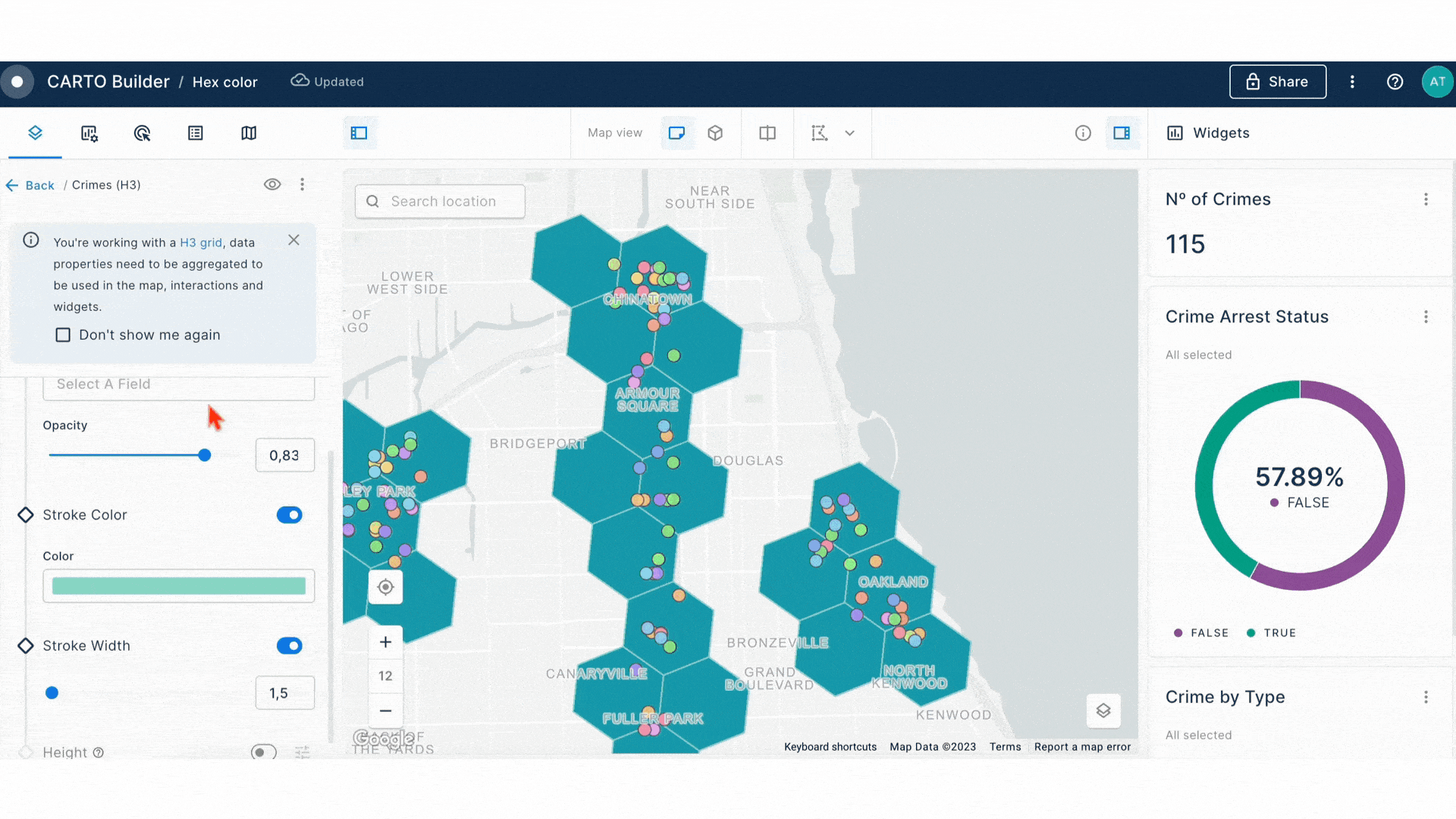
Unlimited styling options for qualitative data using hex color codes
In Builder, users now have the capability to style qualitative data using hex color codes pulled directly from a table or SQL query sources. If you're curious about generating these hex color codes, we've prepared a tutorial to assist you, detailing the steps using either Workflows or SQL. What's especially exciting? The range of possibilities this opens up. Whether you're aligning with your company's brand guidelines, looking to automatically style a high number of categories, or exploring diverse color schemes, the options really are endless.
Measure point-to-point distances between map features in Builder
This quarter we added a new tool to allow users to measure the distance between two points on their maps. This new functionality is ideal for a diverse range of use cases, from planning tasks to gaining a deeper understanding of spatial relationships between various map elements.
.gif)
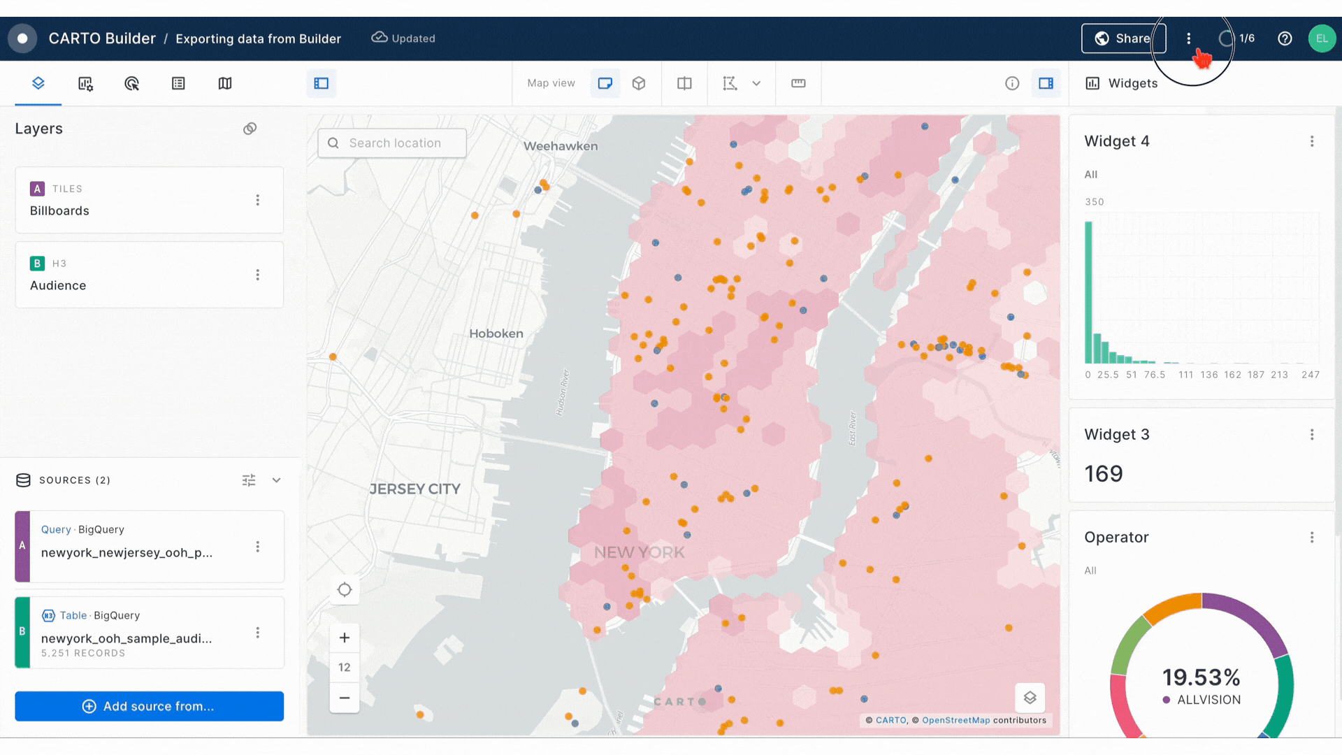
Enhancements to export data from Builder maps
We've upgraded the functionality to export data from your Builder maps, shifting the data export process to work in server-side mode for an enhanced efficiency and data integrity. This improvement ensures a more reliable data retrieval experience, compared to the previous version. Additionally, when exporting data as CSV, it now includes the geometry column in WKT (Well-Known Text) format, if applicable. This enhancement simplifies data handling and boosts compatibility with various geospatial tools, such as QGIS, making integrations smoother.
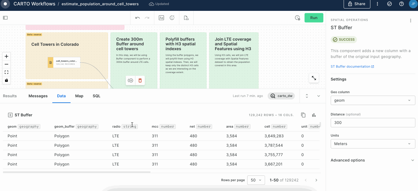
Quickstart your data prep and analysis workflows with one of our templates
We have made a collection of workflow templates available, designed with a hands-on approach to empower our users and ease the learning curve so you can extract the most value out of CARTO Workflows. Our collection of templates showcases a wide range of scenarios, from the simple building blocks for your geospatial analysis to more complex, industry-specific workflows tailored to specific analytical use cases. To benefit from one of our templates, users just need to download the workflow file from our documentation and then import into Workflows in their CARTO account. You can check out our catalog of workflow templates here!
New features for a richer analysis experience in the results panel in Workflows
This quarter we worked on a series of new features in the Results panel in Workflows to provide our users with much richer analytical capabilities and an improved user experience. Among others, we added the possibility to see when the workflow was executed for the last time, and the total number of columns and rows in your results table with the possibility to analyze the entire result set. You can now analyze statistics from each column on the result set, with maximum and minimum, average and sum for numeric columns and the frequency of the Top 20 categories for string, date and timestamp columns. It’s now also possible to copy the content of your result table to the clipboard, ready to be pasted into a spreadsheet. And all that with a renovated, sleeker design!
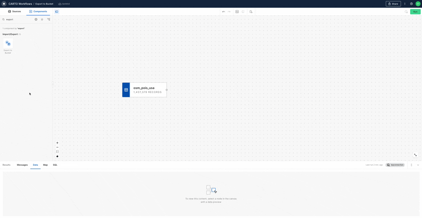
Export workflow results directly to your cloud storage buckets
We released a new component in Workflows that lets you export the result from any node in a workflow to a storage bucket. The node's data will be exported as a series of files, and URLs will be stored in a table. Just inspect the Data tab in the results panel to access the links to each file.
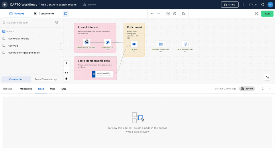
Embed GenAI capabilities into your analysis with the ML Generate Text component in Workflows
We have added a new component to Workflows that leverages BigQuery ML Generate Text capabilities so you can embed Generative AI functionalities into your geospatial analytical pipelines, powered by Google’s Vertex AI natural language foundation models (LLMs). This component can be used to help analyze the result of an enrichment; to automatically generate labels or categories based on variables in your table; or even generate new content for each row on your data, using different variables to compose a prompt that will be called in each row. With this new addition, Generative AI capabilities are now readily available in Workflows. To learn more about how to use this new component watch one of our recent webinars.
New functions in the statistics module of the Analytics Toolbox for Snowflake
Users of our Analytics Toolbox for Snowflake now have access to a new set of functions to compute statistical measures on top of spatial data. This quarter we added support for Local Moran’s I, Geographically Weighted Regression, and Space-time Getis Ord Gi*.

Additionally, we have created the new Retail module, offering access to the COMMERCIAL_HOTSPOTS procedure, which can be used to locate hotspot areas by calculating a combined Getis-ord Gi* statistic over several variables.
Support for OAuth connections in Snowflake
Users can now set up an OAuth integration to connect CARTO and Snowflake. This allows users to follow their usual Snowflake login flow (Snowflake OAuth) when setting up their connections in CARTO, which has added security benefits and is a more familiar process for Snowflake users.
If you have an external identity provider integrated in Snowflake such as Azure Active Directory or Okta, we also support External OAuth to achieve the same process. Read more about Configuring OAuth connections to Snowflake.

We are really excited by this wave of enhancements to the CARTO platform and would like to thank our customers and partners for guiding us on this journey; and remember you can stay up to date on our most recent product releases by regularly checking our What’s New section.
If you would like to find out more about the enhancements we have recently released and see the CARTO platform in action, why not sign up to our What’s New Product Update webinar, taking place on Wednesday 18th January.