

Using Spatial Analysis for 5G Rollout


5G has been the talk of the town (okay world) for years. Afterall from a bird's eye view who wouldn’t be excited to regularly experience faster downloads and less latency? Looking at 5G through binoculars however enhanced mobile broadband (including improved connectivity in rural areas or where there may be internet equity gaps) isn’t the only benefit users are looking forward to once the rollout is complete - this improved form of technology is also going to support IoT improvements as well as be a game changer for mission-critical communications across numerous industries.
Basically in a nutshell: 5G networks foster a host of innovative use cases; it’s going to serve as a bridge between virtually everything from smartphones to wearables to utility management to self-driving vehicles.
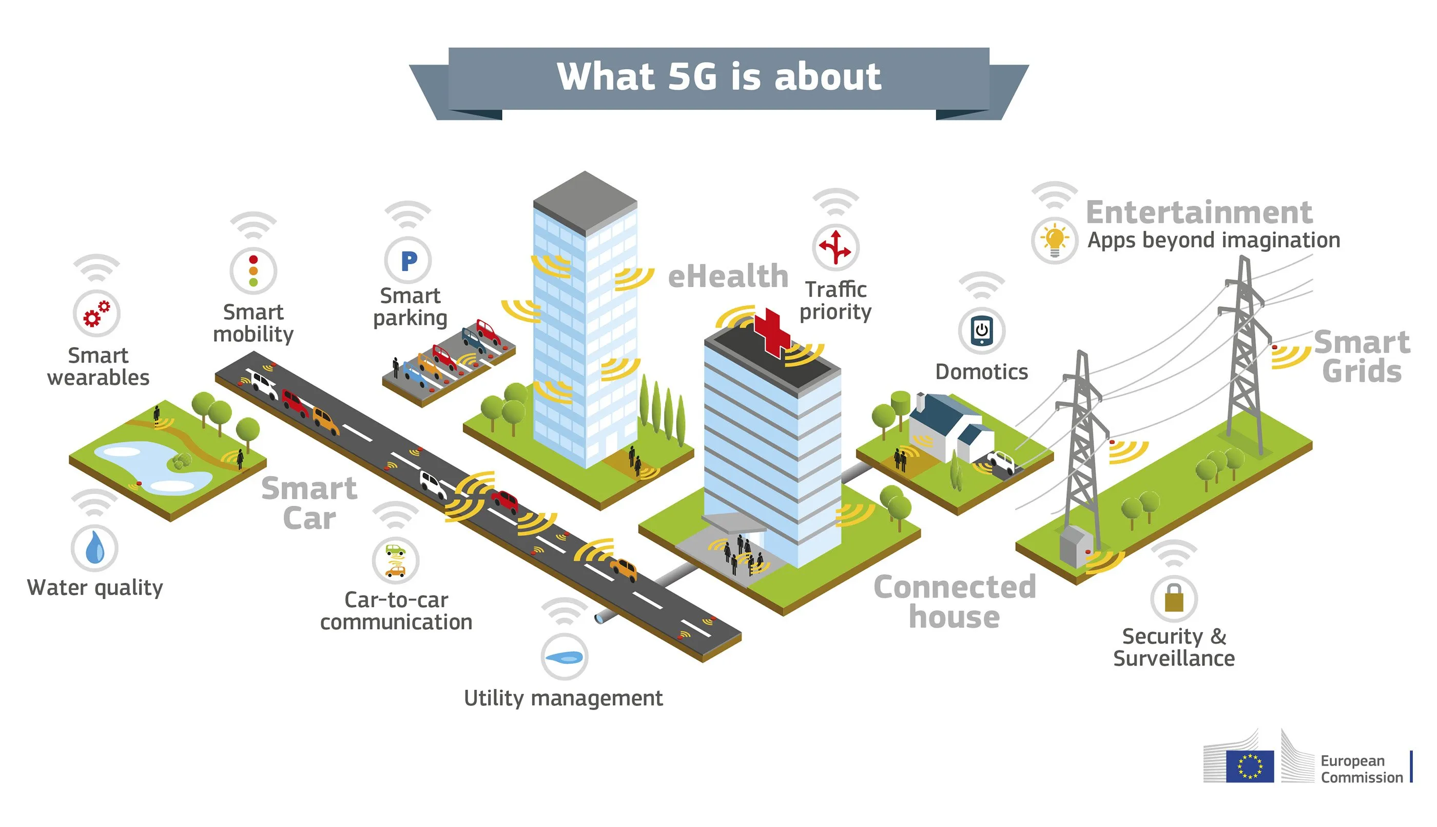
Graph by European Commission.
The conversation around 5G has only accelerated as more telecommunications companies invest in expanding their reach and improving their infrastructure. For example T-Mobile combined two channels of 2.5 GHz mid-band spectrum to increase its 5G network’s speed and network and AT&T plans to reach 200 million people with its C-band service by the end of 2023.
As telco companies continue to strategize and launch phases of their 5G services Location Intelligence is going to be a key driver for proper planning rollout and ongoing optimization. Why? Well because location data is key.
The Importance of Spatial Data for 5G Deployment
When building 5G networks there are many factors to consider including different use cases equipment involved radio propagation site selection for base stations and where to begin rollout to name a few. All of the moving parts involved across each phase of the planning deployment optimization and expansion processes make this service offering a challenging endeavor.
Not to mention 5G is a much more fickle technology than its predecessors. In order to carry larger amounts of data faster 5G operates using higher frequencies with a surprisingly short range and obstructions - as small as a raindrop or as tedious as a sloping roof - can interfere with its signal. Since these radio waves are so sensitive the use of precise spatial data analysis and mapping is crucial to the successful launch and expansion of 5G networks by telecommunications providers. If both the infrastructure involved and connection in general aren’t equally as reliable secure and interoperable the network will not be successful.
So access to rich spatial datasets (like demographics data and even weather data) and spatial analytics plays a key role in helping telecom companies make informed decisions as they create and implement their networks. Also working with a precise cloud-native mapping solution that enables them to easily visualize data and make these informed decisions in an efficient interactive way.
3 Location Intelligence Uses for 5G Rollout
Let’s examine three different approaches for using Location Intelligence for 5G network planning deployment and optimization.
1. 5G Network Planning and Deployment
The primary goal of network planning and deployment is to effectively and efficiently address the needs of the operator and customer. Using GIS in network planning and deployment allows telecom companies to meet these needs as well as…
- Solve challenges around qualification of service
- Determine the site selection of network components
- Decide the best ways to connect the network components
- Identify opportunities for new markets
- Improve service delivery
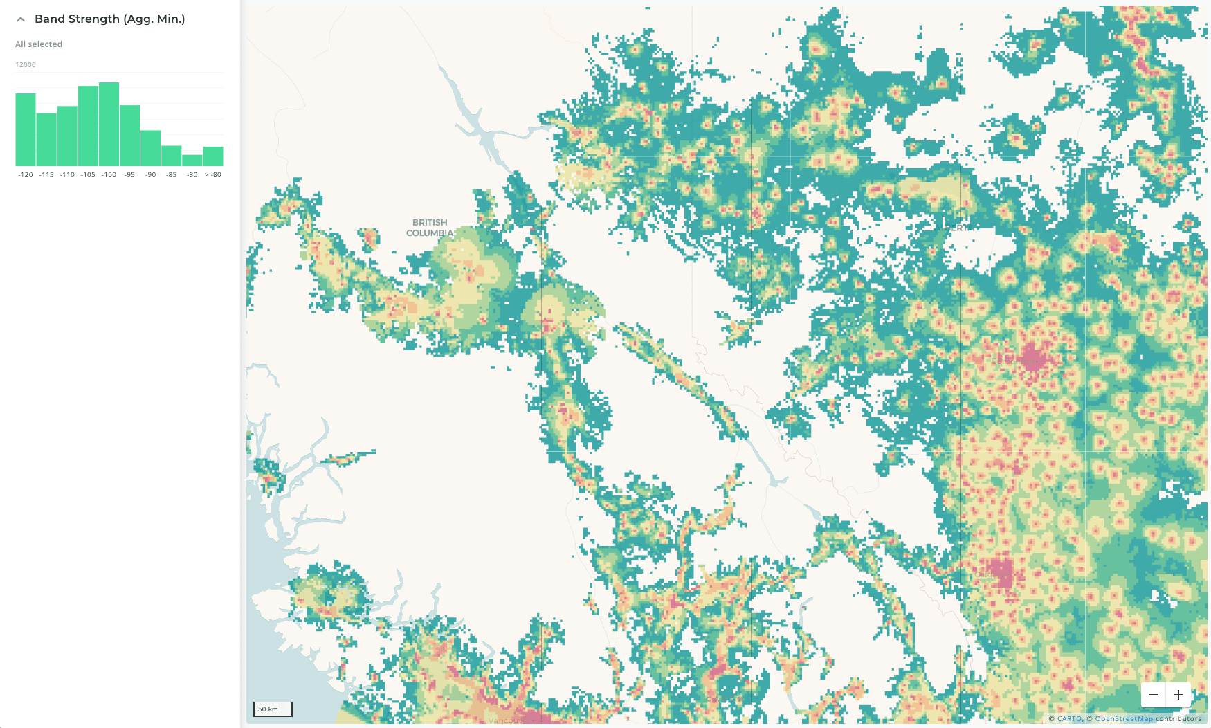
But what’s an example of how a telecom company can incorporate GIS into its 5G network planning and deployment? Well let’s briefly explore T-Mobile’s use case. When planning and deploying its 5G network T-Mobile used spatial indexing to make its complex large datasets more manageable so they could work through crucial challenges like service qualification at scale. To do so they worked with CARTO to build a dashboard that allowed them to easily convert radio frequency propagations into hexbins; this then enabled their geospatial team to visualize and analyze each cell site’s coverage in relation to households to be served.
2. 5G Network Management Optimization and Expansion
Spatial data science is a necessity in order to gain real-time situational awareness so telecom network resources and operations can be managed and optimized effectively. Having the ability to map spatial data can help telecom companies get a pulse-check on the status of their infrastructure visualize the current proximity network towers and cables to customers analyze network suitability for expansion and more.
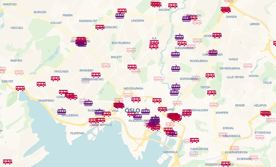
For example TELUS turned to spatial data science so they could use geographic insights to make sure their rollout investment was as efficient as possible and that they were providing the best possible coverage to customers. With our Location Intelligence platform TELUS was able to quickly create and share internal coverage maps that could be used as a reference against their network infrastructure. Also the visualizations they’re able to make by integrating their spatial data into their dashboard help their front line and network support agents troubleshoot network incidents as well as assist technicians in identifying where the strongest signal is located at a location so they can properly install customer equipment.
Additionally TELUS performs analysis using population data road data and area covered so they can easily track the growth of their network by technology market and frequency band.
3. Smart Cities & IoT Planning
According to the Global Commission on Economy & Climate Smart Cities could end up saving the world as much as $22 trillion USD by 2050; and in regards to those in telecommunications the “smartification” of cities is estimated to become a $7.6 billion dollar opportunity by 2023. But how? Well the expansion of 5G networks is the driving force behind smart city development and accurate spatial data and mapping is crucial to effective future-forward digitalization and urbanization.
So how can spatial data and analysis be combined with 5G in smart cities?
Well for one smart cities can utilize 5G technology and road traffic data to communicate road conditions to sensors and devices that power transportation and traffic systems. If commuter traffic congestion is detected these devices are able to quickly and automatically redirect traffic and give autonomous vehicle systems a heads up about real-time issues on the road.
Spatial data can also be used in other areas prime for optimization. For example Telefónica uses GIS to turn data from thousands of IoT sensors into actionable insights that allow their public sector customers to make decisions to help their cities run not only more efficiently but sustainably as well. With machine learning algorithms and faster processing with 5G speeds these clients are able to optimize resources including waste collection and energy costs and reduce their carbon footprint.
Spatial Analysis and 5G Go Hand-in-Hand
From network planning and deployment to maintenance and optimization spatial analysis is key for the successful rollout of 5G networks. If you’re interested in incorporating spatial analysis into your telecommunication company’s 5G network rollout get in touch to schedule a demo of the CARTO platform today.


