CARTO 2018: Our Year In Review


2018 is drawing to a close and here at CARTO it has been a year for the record books. From January’s company retreat in Valencia to this month's inclusion as Strong Performers in Forrester’s Location Intelligence Wave Report we aimed for the stars and had a lot of fun along the way.
Below are a few accomplishments made possible thanks to a team that brought passion curiosity and dedication to each and every challenge in 2018. This was the key to our successes this past year and it’s our driving force heading into 2019.
So for your pleasure we present CARTO's year in review! Vamos!
January
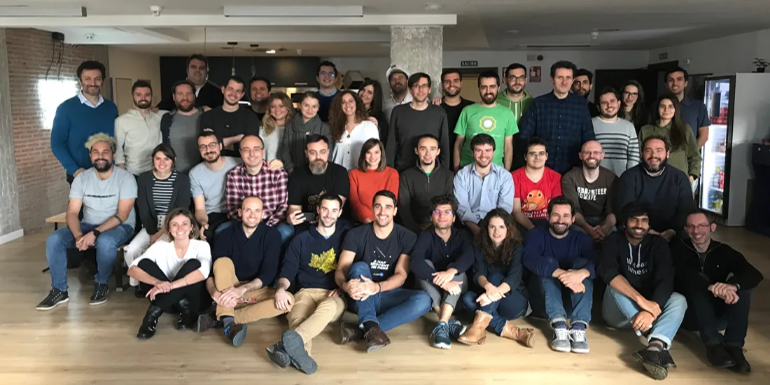
The year kicked off with a retreat for the entire company in Valencia where different teams shared their plans for 2018. From our commercial vision for the year to new features and solutions from our product and Data Science teams the week laid out an ambitious plan on new and exciting ways of making Location Intelligence more accessible to our user community.
February
Alongside tech and telecommunications leaders from around the world in February we headed to Barcelona for Mobile World Congress 2018. This year’s congress was particularly exciting as we announced a new jointly-built solution called Vodafone Analytics allowing Vodafone to accelerate their data monetization journey alongside their B2B customers across the world.
##_IMAGE_SIZE_LIMT_## https://carto.com/media-content/blog/img/posts/2018/2018-12-26-carto-year-in-review/analytics-footfall.gif##_IMAGE_SIZE_LIMT_##

Since its debut new features have been added equipping users with insights on mobility patterns for better decision making in Retail Real Estate Tourism Public Administration and more. In October public officials in Bizkaia used Vodafone Analytics to manage monitor and measure the local impact of MTV Music Week with data from IoT sensors.
March
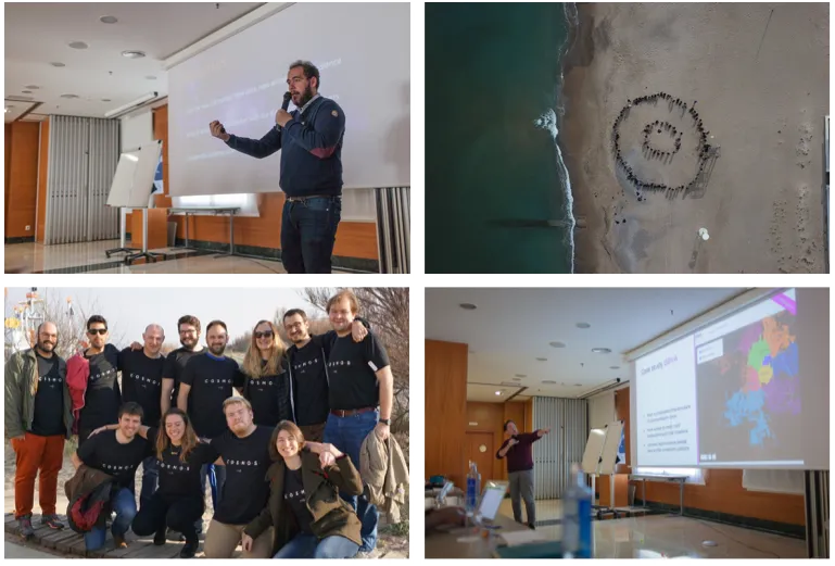
Our Data Science team participated in several events to celebrate NYC Open Data Week 2018. Partnering with Enigma and SAVI Pratt we kicked off the week with Data Through Design an art exhibit presenting viewers with a tactile view of open data.

Later in the month CARTO was featured in a new publication from Alex D. Singleton Seth E. Spielman and David C. Folch titled Urban Analytics for its commitment in moving beyond traditional GIS.Urban analytics "the practice of using new forms of data in combination with computational approaches to gain insight into urban processes " addresses the impact mobility problems have on city residents. And to exemplify this impact and the role of data visualization in presenting this information the authors highlighted the L Train Shutdown Analysis from Stuart Lynn Head of Data Science and Mamata Akella Head of cartography.
April
The entire CARTO team worked around the clock to finalize preparations for not one but two industry summits bringing Location Intelligence practitioners and pioneers to Spain in April for CARTO Locations Madrid.

The two day summit featured exciting presentations from industry experts on the latest advancements in Location Intelligence demonstrating innovative ways of working with location data. Highlights included:
- BBVA using spatial analytics to power their Urban Discovery Project
- Descrifa building predictive models to drive long-term retail planning
- TomTom using GPS and mobile data to enhance mobility insights
And as the summit drew to a close our CEO Javier de la Torre invited to the stage Luis Cueto the Mayor of the City of Madrid and Avichai Bakst from Waze Connected Citizens Program for one last announcement: a new partnership and traffic management and mobility solution called Traffico.
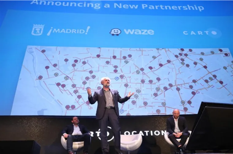
Since then we’ve helped cities and local governments from San Diego California to Louisville Kentucky address mobility problems by connecting Waze traffic data to city-specific tools apps and dashboards using our Location Intelligence platform.
May
Once Locations Madrid ended we shifted focus to finalizing details on new projects slated to be announced at CARTO Locations New York especially the beta release of Airship. For developers Airship provides a frontend library whose ready-to-use layout elements components CSS styles and icons were specifically designed to avoid problems Location Intelligence Apps often encounter.
In the last six months the team behind Airship has expanded the initial library's components and in November Airship v1.0 launched featuring an independent framework mobile readiness and interactive elements that improve data storytelling.
June
At Locations New York we presented CARTO VL as the future of digital cartography and since June we've been building maps that surpass what was once thought possible. In early June the product team hosted an internal CARTO VL hackathon which received some truly amazing submissions. We also mapped the spread of forest fires across the U.S. with VL and along the way discovered other patterns including the relative speed at which some fires were growing. In the clip below listen to some of our team discuss the advancements in web mapping that the wildfire map displays:
In November CARTO VL v1.0 was released with extensive documentation available in the Developer Center.
July
CARTO Locations featured presentations highlighting the added value of location data streams and to kick off the second half of 2018 we spotlighted new ways of solving old problems by applying spatial data science techniques to these new data streams. Topics included:
Site planning for food trucks with mobility data

Optimizing sales territories with genetic algorithms
Predicting traffic collisions with GPS and mobile data
These stories reminded us why spatial data science and location data streams are so powerful when combined to solve real-world problems.
August
Summer months might normally be a little quieter but our Solutions and Design teams spent August finding ways to improve the online experience for CARTO users. What came from their hard work was a new Help Center with tips on getting started building a map and working with your data the Developers Center which provides resources like APIs and Libraries that will help build the next generation of Location Intelligence applications and a redesigned home page.
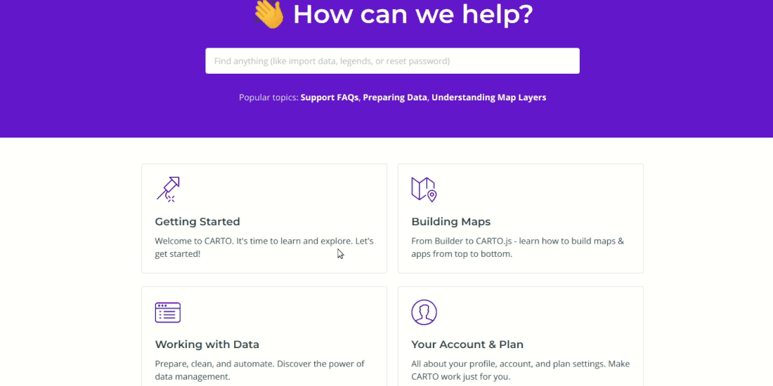
From introductory guides on data preparation to specific tutorials on working with CARTO.js and MAPS API quick DIY refreshers on SQL and PostGIS the Help Center provides an entry point into CARTO that the Developer Center advances with more technical guides and references on building Location Intelligence apps on CARTO's platform.
October
The 2018 Spatial Data Science Conference was held on October 12th in CARTO's Brooklyn Office. Co-sponsored by The Center for Spatial Data Science at the University of Chicago the day long conference featured dozens of talks keynotes and panel discussions exploring the challenges of working with spatial data from public and private sector leaders alongside academics and researchers.
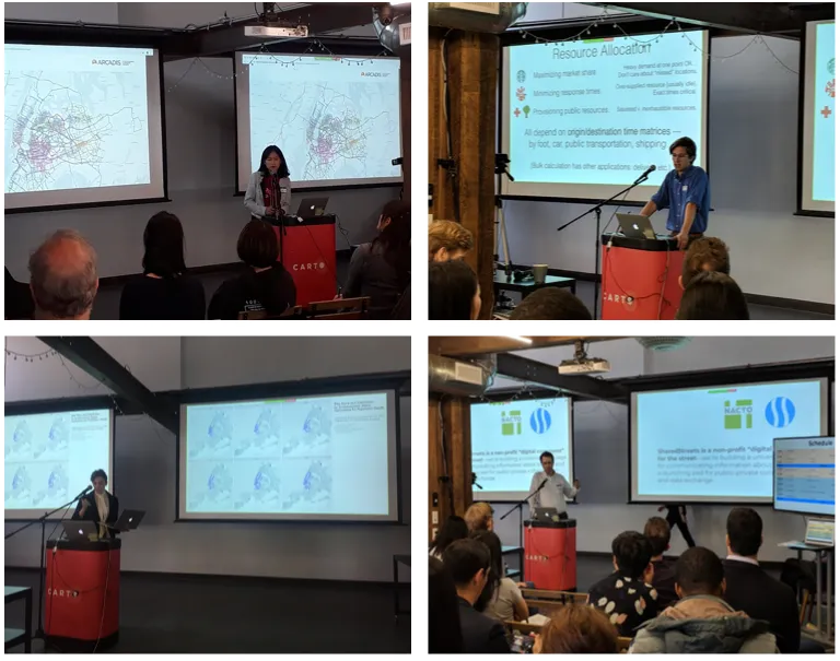
Check out our microsite for recordings of the presentations and keep an eye out for our 2019 edition!
November
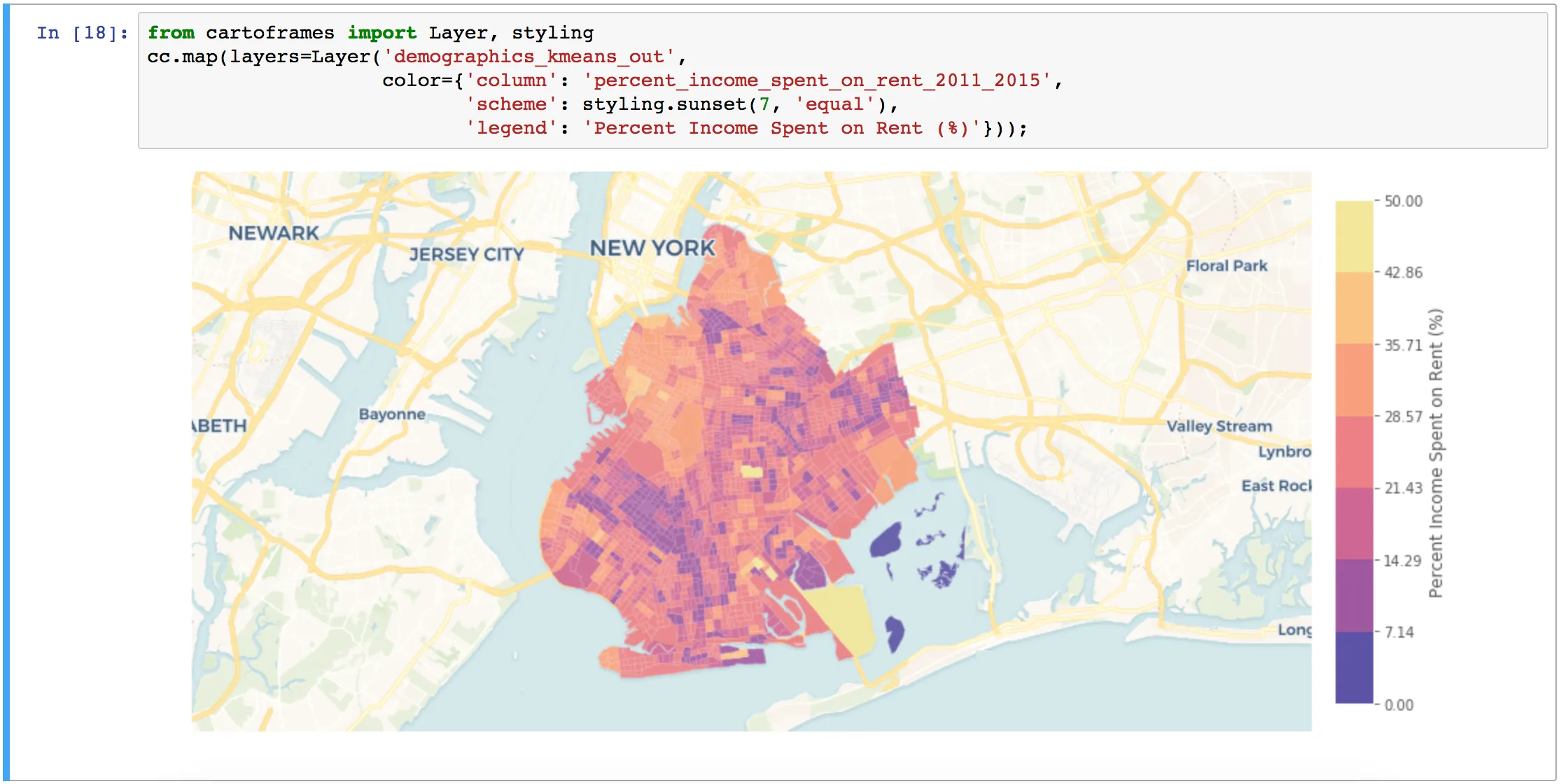
November marked the first anniversary of CARTOframes. As a Python package designed to easily get data into and out of CARTO CARTOframes creates an ETL workflow native to Data Scientists that includes standard languages and tools including Jupyter notebooks Geopandas Matplotlib and SQL and PostgreSQL. Because CARTOframes interacts with Matplotlib static data visualizations can be pulled from the Maps API and generated using a single line of code.
Make sure you don’t miss our January webinar with CARTOframes guru Andy Eschbacher!
December
After an intense and prosperous year the CARTO team were excited to be included in Forrester’s Location Intelligence Wave as a Strong Performer as well as receiving recognition from Gartner in their Outdoor Mapping and Location Services Competitive Landscape Report.
And that's a wrap on CARTO 2018! Happy holidays and we look forward to an even busier 2019!